

PArks
To register for our programs, stop by the Parks and Recreation Office or call (660) 826.4930.
Payment is required at the time of registration. We accept Cash, Check, Visa, MasterCard, Discover, and American Express.
You can also register online (for most activities) at https://registration.sedaliaparks.com
Late Registration Policy: If availability allows, and we accept registration after the deadline, a $5 late fee will apply to programs and a $20 late fee will apply to all leagues.
Restroom Availability:
Park restrooms are winterized and closed approximately from November 1 through March 31. They are typically reopened and available for use from April 1 to October 31, weather permitting. Please note that freezing temperatures or instances of vandalism may delay opening or cause temporary closures.
Shelter Rentals
Reservations are available April 1st – October 31st.
Reservations cannot be made more than one year in advance.
Deadline for weekend rentals is the Thursday before the rental. Deadline for weekday rentals is two business days before the rental.
SIZES, TABLE AMOUNT, SEATING AND RATES –
• X-Large size – 20 tables, seats approx. 180 – $55
• Large size – 16 tables, seats approx. 100 – $50
• Medium size – 10 tables, seats approx. 60 – $45
• Small size – 6 tables, seats approx. 35 – $40
• Mini size – 4 tables, seats approx. 25 – $35
• Hubbard with Concession – $95
• Hubbard Key Deposit – $50
Shelter Rentals and Special Event Permitting Policy
Shelter Rental Agreement
• Rental fees are due in full when the reservation is made. Phone reservations are only made with debit or credit cards.
• Shelters can be rented from April 1 to October 31 each year. Shelters can be rented from 8:00 a.m. to 10:00 p.m.
• Shelters can be rented no more than one year in advance. Note: this is by calendar date.
• The reservation deadline for weekend rentals is no later than 12:00 p.m./Noon on the Thursday before. (This also applies to any holidays that fall on a Monday).
• The reservation deadline for weekday rentals is no later than 2 business days before the rental.
• Cancellation policy: Cancellations must be made during business hours before your rental date to receive a refund. Otherwise, no refunds are given.
• Alcoholic beverages are not permitted on park grounds.
• Smoking is not permitted on park grounds.
• Be respectful of other rentals and park guests in regards to noise level.
• Live music is not permitted without prior Director approval.
• Decorations: No tape, staple guns, nails or anything else that could leave permanent damage. No confetti.
• Renters will need to remove all trash from shelter before leaving (there are trash cans at each shelter and additional cans throughout the parks,
• Bounce houses are not allowed. Privately owned, non‐commercial bounce houses and other similar inflatable/apparatus, including but not limited to those that use water or have water features as part of the bounce house, inflatable, and similar apparatus, are prohibited on Sedalia Parks and Recreation property. Commercial bounce houses and other similar inflatable/apparatus, are also prohibited on Sedalia Parks and Recreation premises.
• Also prohibited: petting zoos; water balloons; water sprinklers; dunk tanks; sprinklers; slip ‘n slides; Chinese lanterns; firearms/weapons; open flames/candles; tiki torches; cooking grills (excludes cooking grills provided by SPR) and ziplines.
• Minimal electric is provided at most shelters. One crockpot per outlet allowed. Electric service provided will not power bounce houses, which are not allowed on park property or sound systems.
• Glass: No items in glass containers.
• Extra Large shelters have approximately 20 tables, Large shelters have approximately 16 tables, Medium shelters have approximately 10 tables, Small shelters have approximately 6 tables, and Mini shelters have approximately 4 shelters.
• Tables are not to be removed from your shelter for any reason. Do not take tables from other shelters. Consider bringing lawn chairs if you have a large group.
• Do not drive over curbs or on the grass to park or unload. No parking, driving, or unloading on the grass or walking paths.
• Not all bathrooms are available at the beginning and near the end of the rental season.
• For maintenance issues during your rental, call (660) 826-4930.
Renters must be at least 21 years old.
Centennial Park
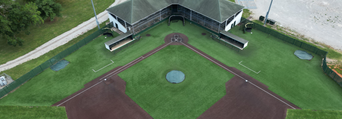
The fifth park that was added to the park system was Centennial Park in 1960. Centennial Park, located at 16th Street and New York, is the second largest of all existing parks with 39 acres. The main function of this park is an outdoor sports complex, which consists of 8 lighted ballfields, and a swimming pool. We have security lighting, playgrounds, swings, slides, climbers, and five shelter houses. Centennial Park’s outdoor walking trail is one mile for one lap.
Centennial Park map here.
Centennial Park 3D Tour here.
- Shelter 1: X-Large size, 20 tables, seats approx. 180.
- Shelter 2: Small size, 6 tables, seats approx. 35
- Shelter 3: Small size, 6 tables, seats approx. 35
- Shelter 4: Small size, 6 tables, seats approx. 35
- Shelter 5: Small size, 6 tables, seats approx. 35
- Shelter GSB: Small size, 6 tables, seats approx. 35
- Baseball fields
- Walking trail
- Basketball Court
- Restrooms
- Playground
DIRECTIONS
- From the North: 65 Hwy (Limit Avenue) to 16th Street, turn left. Continue on 16th Street approx. 2.3 miles.
- From the South: 65 Hwy (Limit Avenue) to 16th Street, turn right. Continue on 16th Street approx. 2.3 miles.
Continue on 16th St. and turn right on New York Ave. The playground area, shelters, and ballfields will be on your right.
- From the East: 50 Hwy (Broadway) to New York Avenue, turn left.
- From the West: 50 Hwy (Broadway) to New York Avenue, turn right.
At New York Avenue & 16th Street, turn right for Centennial Pool or continue straight for other areas of the park. The playground area, shelters, and ballfields will be on your right.
Katy Park
The sixth park to be added to the system is Katy Park. Katy Park is located at 24th and Grand and is 18 acres in size. Katy has recently undergone some development with the addition of a skateboard park, modular playground system, restroom facilities, water fountains and electricity being added to the shelter houses. Katy Park was purchased in 1974 and finalized in 1976 through a grant. Other facilities available are a practice baseball field, two shelter houses and one practice field for soccer with a soccer backstop. Katy Park’s outdoor walking track is 0.7 miles for one lap.
Katy Park map here.
Katy Park 3D Tour here
- Shelter 1: Small size, 6 tables, seats approx. 35
- Shelter 2: Small size, 6 tables, seats approx. 35
- T-ball Fields
- Restrooms
- Playground
- Skate park
- Soccer field
- Whiteman Memorial
- Walking Trail
DIRECTIONS:
- From the North: 65 Hwy (Limit Avenue) to 16th Street, turn left. 16th Street to Grand Avenue, turn right. For the Skate Park, turn right on Clinton Rd; the Skate Park will be on your left. For the playground and shelters, continue on Grand Avenue and turn right on 24th Street; these areas will be on your right.
- From the South: 65 Hwy (Limit Avenue) to 32nd Street, turn right. Immediately turn left on Clinton Rd. For the playground and shelters, turn right on 24th Street; the park areas will be on your left. For the Skate Park, continue on Clinton Road; the skate park will be on your right.
- From the East: 50 Hwy to Grand Avenue, turn left. For the Skate Park, turn right on Clinton Rd; the Skate Park will be on your left. For the playground and shelters, continue on Grand Avenue and turn right on 24th Street; these areas will be on your right.
- From the West: 50 Hwy to Grand Avenue, turn right. For the Skate Park, turn right on Clinton Rd; the Skate Park will be on your left. For the playground and shelters, continue on Grand Avenue and turn right on 24th Street; these areas will be on your right.
Skate Park
Rules and Regulations
WARNING! The facility is unsupervised and uninsured.
Any use is at your own risk. Use may result in serious injury.
SAFETY EQUIPMENT
It is strongly recommended that the following safety equipment be worn at all times to help provide suitable protection in the event of falls or collisions:
Helmet * Knee Pads * Elbow Pads * Wrist Guards
PLEASE REMEMBER
* The Skate Park is designed for skateboards, skates, and rollerblades. No bicycles or scooters.
* Hours of permitted use are from 7:00 a.m. to Sundown. It shall be unlawful for any persons to remain on the premises outside the posted hours.
* The Sedalia Parks & Recreation Department is not responsible for any activities held at this location.
* No glass containers, food, or beverage allowed on the skating surface. Spills jeopardize the skaters.
* No other items such as benches, tables, wood materials, or other objects used as ramps or jumps are allowed in the skate park facility.
* No pets are allowed in the skate park area.
* No skating against the traffic.
* Do not proceed down a ramp until clear of other skaters.
* Alcohol, tobacco, and/or drugs are prohibited.
SEDALIA PARKS & RECREATION DEPARTMENT
RESERVES THE RIGHT TO:
* Close the facility for any circumstances deemed necessary.
* Restrict entry to the facility and to ban persons from the facility if any of the rules
are not followed, or if unsafe behavior is observed (Park Board Policy).
PLEASE REMEMBER
Skate with safety in mind and remember weather conditions may create unsafe surfaces for skating.
MAINTAINING THE FACILITY
Please report maintenance concerns to the Park & Recreation Office 826-4930. Messages may be left 24 hours a day.
SERIOUS INJURIES
In case of serious injury or other emergency, call 911. The phone is located at the northeast corner of the parking lot, near the walking trail. The facility is located in Katy Park, South Grand and Clinton Road.
PLEASE USE COMMON COURTESY & SKATE FRIENDLY
Clover Dell Park
The seventh and most recent park to be added to the system is Clover Dell Regional Park. Clover Dell is located on West 32nd Street, 8/10 of a mile from the city limits. Clover Dell is a 173 acre park. Development of a soccer complex with concession/restroom facilities has been completed, as well as a 12 acre lake in cooperation with the Department of Conservation Community Assistance Program. 8 Soccer Fields, 18 Hole Frisbee Golf Course, Access to Katy Tail, Clover Dell Lake, Shelter, Bathrooms. Currently the RC Track indicated on map is unusable.
Clover Dell Park map here.
Clover Dell Park 3D Tour here
- Soccer Shelter: X-Large size, 20 tables, seats approx. 180.
- Lake Shelter: Small size, 6 tables, seats approx. 35
- Restrooms
- Disc Golf Course
- Soccer Fields
- Dog Park
- Archery Range
- Playground
- Lake with fishing access
- Walking Trail & Cross Country Trail
DIRECTIONS:
- From the North: 65 Hwy to 32nd Street stoplight, turn right. The road will fork; you will need to immediately turn right to stay on 32nd Street. Continue on 32nd St. approx. 1.5 miles, the park entrance is on the left.
- From the South: 65 Hwy to 32nd Street stoplight, turn left. The road will fork; you will need to immediately turn right to stay on 32nd Street. Continue on 32nd St. approx. 1.5 miles, the park entrance is on the left.
- From the East: 50 Hwy to 65 Hwy, turn left. 65 Hwy to 32nd Street stoplight, turn right. The road will fork; you will need to immediately turn right to stay on 32nd Street. Continue on 32nd St. approx. 1.5 miles, the park entrance is on the left.
- From the West: 50 Hwy to 65 Hwy, turn right. 65 Hwy to 32nd Street stoplight, turn right. The road will fork; you will need to immediately turn right to stay on 32nd Street. Continue on 32nd St. approx. 1.5 miles, the park entrance is on the left.
Dog Park
- Located at Clover Dell Park and is free to the public. No membership or fees required! There is a fenced area for large and small dogs. Bring your friendly four legged friends out for some fun!
Hubbard Park
The second park to come into the Sedalia park system was Hubbard Park, which was donated by Mrs. Cotton in 1921. Hubbard is located at Johnson and Missouri streets and is 23 acres in size. Hubbard consists of five shelter houses, security lighting, water fountains, two restrooms and a lighted baseball field as well as swings, slides and a new modular playground system, and two basketball courts. There is also a concession stand and support facilities. Hubbard Park walking track distance is 0.5 miles for one lap.
Hubbard Park map here.
Hubbard Park 3D Tour here
- Shelter 1: X-Large size, 20 tables, seats approx. 180; has optional concession area with fridge and counters rentable for extra fee.
- Shelter 2: Small size, 6 tables, seats approx. 35
- Shelter 3: Medium size, 10 tables, seats approx. 60
- Shelter 4: Mini size, 4 tables, seats approx. 25
- Shelter 5: Mini size, 4 tables, seats approx. 25
- Shelter 6: Mini size, 4 tables, seats approx. 25
- Baseball field
- Basketball Court
- Restrooms
- Playground
- City Hospital #2 Memorial
- Splash Pad
-
DIRECTIONS
- From the North: 65 Hwy to 3rd Street, turn left. 3rd Street to Missouri, turn left. The park will be on your left.
- From the South: 65 Hwy to Main Street exit. After taking exit, turn right onto Main St. Turn left on Missouri Avenue, the park will be on your left.
- From the East: 50 Hwy to Grand Avenue, turn right. Turn right on Cooper Street. Turn left on Missouri; park entrance will be on your left.
- From the West: 50 Hwy to 65 Hwy, turn left. Take Main Street exit, turn right onto Main St. Turn left on Missouri Avenue, the park will be on your left.
Splash Pad
The Splash Pad is closed for the 2025 season. We will reopen Memorial Day Weekend 2026.
6/20 at 5:15pm-Splash Pad is OPEN! Yes we have a mess out there and contractor will return on Monday (6.23/25) morning to hopefully get it completely repaired…Enjoy!!!
6/20 Update-Contractor is currently working on site on repairs.
6/18 update-Company will be on site 6/19 at 10:30 and we will know more and send out another update.
6/13/25: Dear Community Members,
We would like to inform you that the Splash Pad will be operational this Saturday, June 14th and Sunday, June 15th from 11:30 AM to 5:00 PM, despite ongoing maintenance. We appreciate your understanding as we work diligently to resolve the issues at hand. A company will be on-site this Monday to assess and hopefully fix the problem.
Please note that while the Splash Pad is running, there will be a temporary closure of the East basketball court due to the leak. We apologize for any inconvenience this may cause and are committed to making this situation work for everyone.
On Monday, June 16, the Splash Pad will be closed to facilitate repairs, and we will provide you with updates on our progress. We genuinely appreciate your patience during this time, as we share your desire to see the Splash Pad fully operational for the enjoyment of all.
Thank you for your understanding. We will follow up with an update on Monday June 16th, in the evening, after we have further information.
Amy Epple
Director of Sedalia Parks and Recreation
5/31/25: Hubbard Park Splash Pad is closed until further notice due to a leak. We have reach out to the company to come look at the Splash Pad as it is still under warranty. We are awaiting a call back from them. Please check back for opening date.
- Hours of Operation: 10am – 8 pm, Memorial Day to Labor Day
- Free and open to the public
- Splash pad rules
- Sorry, no private rentals at this time.
Housel Park
The third park brought into the parks system was Housel Park, which was purchased in 1942 with additions in 1973 and 1984. Housel Park is located at Howard and Hurley and is approximately five acres in size. Housel Park has one very active ballfield, as well as restrooms, two shelter houses, tiny tot play area, lighted basketball court, security lighting, swings, slide and support facilities.
Housel Park map here.
Housel Park 3D Tour here
- Shelter 1: Small size, 6 tables, seats approx. 35
- Baseball field
- Basketball Court
- Restrooms
- Playground
Vermont Park
The fourth park to be added to the system was Vermont Park in 1951. Pfeiffer Woods-Vermont Park is located at Vermont and 14th Street and is approximately 7 acres in size. Vermont Park was renamed to Pfeiffer Woods-Vermont Park in 1986. Pfeiffer Woods-Vermont Park consists of: a basketball court, a multi- court, playground facilities, 2 small practice field, security lighting and shelter with restrooms, and walking path. Vermont Park’s walking path distance is 3 laps equal one mile.
Liberty Stadium
Liberty Stadium game schedules can be found here.
Liberty Park Stadium Schedule 2026
Please Note:
The Liberty Park Stadium calendar is subject to change and may not reflect the most up-to-date game schedules or times. For the most accurate information regarding games, times, and admission fees, please refer directly to the website or Facebook page of the hosting organization or league.
All questions about schedules, game day details, or admission should be directed to the team or organization hosting the event. Sedalia Parks & Recreation does not manage individual team schedules or event logistics. Thank you for your understanding!
Liberty Park
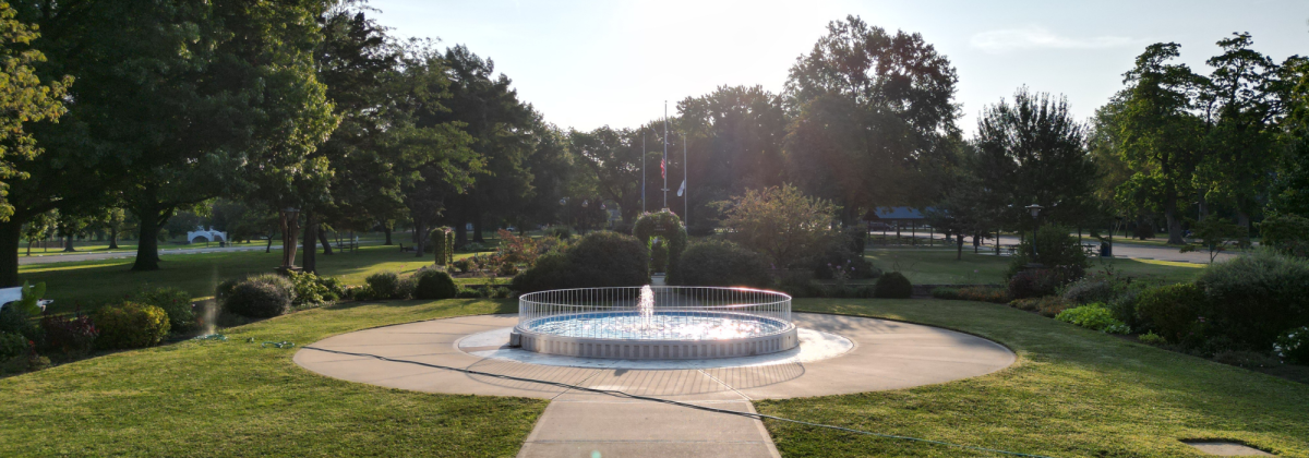
Liberty Park is approximately 32 acres in size and was purchased in 1890 from Joseph Sicher. Today in Liberty Park, there is the main building, Convention Hall, which houses the Parks and Recreation Office. The building has an auditorium for recreation programs, an upstairs for dance programs and meeting rooms, as well as restroom facilities.
The Parks Management and Operations Office is located in Liberty Park as well. This office houses the maintenance personnel and all equipment for the upkeep of facilities.
We have security lighting, water fountains, playground equipment, two basketball courts, six lighted tennis courts, six shelter houses, a lake for recreational fishing, a rose garden, lighted baseball stadium with seating, restrooms and a concession stand, picnic areas, sand volleyball courts, Liberty Land train with a 1/8 mile track and a lighted Little League baseball stadium.
Liberty Park map here.
Liberty Park 3D Tour here
- Shelter 1: Medium size, 10 tables, seats approx. 60
- Shelter 2: Medium size, 10 tables, seats approx. 60
- Shelter 3: Large size, 16 tables, seats approx. 100.
- Shelter 4: Small size, 6 tables, seats approx. 35
- Shelter 5: Small size, 6 tables, seats approx. 35
- Shelter 6: Small size, 6 tables, seats approx. 35
- Basketball Court
- Restrooms
- Playground
- Lagoon with fishing access
- Tennis Courts
- Bandstand
- Convention Hall
- Firefighter’s Memorial
- Liberty Stadium
- Baseball Field (Vansell)
- Liberty Pool
DIRECTIONS
- From the North: 65 Hwy (Limit Ave) to 3rd Street, turn left.
- From the South: 65 Hwy (Limit Ave) to 3rd Street, turn right.
- From the East: 50 Hwy to 65 Hwy, turn right. Turn right on 3rd Street.
- From the West: 50 Hwy to 65 Hwy, turn left. Turn right on 3rd Street.
Once you are on 3rd Street, Liberty Pool and the other areas of Liberty Park will be on your left.
Convention Hall Rentals
Rental fees of the gym for activities are $300 per day. The damage deposit for all gym rentals is $300 per day. Insurance may be required for some rentals. Convention Hall Gym is 125ftx68ft. Rentals include access to tables and chairs. Call the park office for availability at 660-826-4930.
Walking is available in Convention Hall during open hours. 19 laps around the black basketball court line is 1 mile. Call 660-826-4930 for availability.
Polar Express
December 6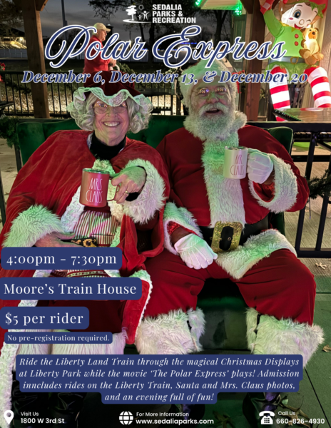
December 13
December 20
Moore’s Trainhouse
4:00pm – 7:30pm
All Ages
$5 per rider
No pre-registration required.
Experience the magic of the holiday season aboard the Polar Express at Moore’s Trainhouse! On select evenings, families are invited to climb aboard for a festive train ride filled with twinkling lights, holiday cheer, and Christmas magic around every turn. Wear your favorite pajamas, bring your holiday spirit, and create lasting memories with family and friends.
Spooky Express
October 29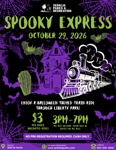
Moore’s Trainhouse
3:00pm – 7:00pm
All Ages
$3 per rider
No pre-registration required.
All aboard for a not-so-scary Halloween adventure! Climb aboard the Spooky Express at Moore’s Trainhouse and enjoy a festive train ride filled with Halloween fun, and fall decorations! Costumes are encouraged, so come dressed in your favorite Halloween attire and make memories with the whole family. Whether you’re a little ghost, superhero, princess, or pumpkin, this is the perfect way to celebrate the season!
Moore’s Train House at Liberty Park
Rentals
During the normal operating season from Memorial Day through Labor Day, private rentals are available on Saturdays and Sundays from 1:30–3:30 pm. The cost is $210 for a two-hour rental and includes up to 50 participants who will ride the train. Additional riders may be added for $2 per person. Rental includes one train conductor, one train engineer, unlimited rides for party participants, and use of the Moore’s Train House shelter space, located on the south end of the shelter.
Weekday school group field trip rentals are available from mid-April through mid-October, Monday through Friday between 8:00 am and 4:00 pm. These rentals are $125 for a two-hour rental and include up to 50 students or participants, with chaperones riding free. Additional riders are $2 per person.
Other rental times may be available before or after the Memorial Day–Labor Day season, depending on availability. To check the calendar and reserve your date, please email [email protected].
Reservations must be made a minimum 7 days in advance and be approved by SPR staff.
Cancellations
Inclement Weather
If it is determined 24 hours prior to rental date that the Train will not be able to run, lessee can choose 1. Full refund, 2. Partial refund and lessee can still use Moore’s Train House shelter for $30 for the two (2) hours timeframe of rental (SPR will refund train costs and only charge for shelter rental), or 3. Reschedule party to next available open rental slot.
Example: If rental is scheduled from 9:00am-11:00am, train is operational from 9:00am-10:15am, then it begins to rain – no refund will be given.
If rental is scheduled from 9:00am-11:00am, train is operational from 9:00am-9:30am, then it begins to rain, a refund of total rental rate minus $30 for shelter rental will be given.
For safety and mechanical reasons, the train cannot operate when there is any rain or condensation on the tracks. If the train closes due to inclement weather/track conditions, it will reopen as soon as the tracks are dry and it is safe to operate. Train conductor and Sedalia Parks and Recreation Staff will make the determination of when train rides must cease and when they may reopen.
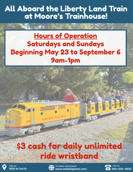
Normal Operating Season
Memorial Day to Labor Day, unless otherwise posted.
For 2026, Saturdays and Sundays from 9am-1pm (Memorial Day to Labor Day, May 23-September 6, 2026).
$3 per ticket per person for all day unlimited rides (unless otherwise posted). Ticket is good for day of purchase only.
For safety and mechanical reasons, the train cannot operate when there is any rain or condensation on the tracks. If the train closes due to inclement weather/track conditions, it will reopen as soon as the tracks are dry and it is safe to operate. Train conductor and Sedalia Parks and Recreation Staff will make the determination of when train rides must cease and when they may reopen. Sign up for text alerts by texting SPRALERT to 888777.
Memorial Bench
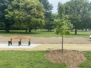 Please see below for information on our memorial bench program. If you have any questions, please give us a call at 660 826-4930. We would be happy to help you!
Reservations are available April 1st – October 31st.
Reservations cannot be made more than one year in advance.
Deadline for weekend rentals is the Thursday before the rental. Deadline for weekday rentals is two business days before the rental.
SIZES, TABLE AMOUNT, SEATING AND RATES –
• X-Large size – 20 tables, seats approx. 180 – $55
• Large size – 16 tables, seats approx. 100 – $50
• Medium size – 10 tables, seats approx. 60 – $45
• Small size – 6 tables, seats approx. 35 – $40
• Mini size – 4 tables, seats approx. 25 – $35
• Hubbard with Concession – $95
• Hubbard Key Deposit – $50
Shelter Rentals and Special Event Permitting Policy
Shelter Rental Agreement
• Rental fees are due in full when the reservation is made. Phone reservations are only made with debit or credit cards.
• Shelters can be rented from April 1 to October 31 each year. Shelters can be rented from 8:00 a.m. to 10:00 p.m.
• Shelters can be rented no more than one year in advance. Note: this is by calendar date.
• The reservation deadline for weekend rentals is no later than 12:00 p.m./Noon on the Thursday before. (This also applies to any holidays that fall on a Monday).
• The reservation deadline for weekday rentals is no later than 2 business days before the rental.
• Cancellation policy: Cancellations must be made during business hours before your rental date to receive a refund. Otherwise, no refunds are given.
• Alcoholic beverages are not permitted on park grounds.
• Smoking is not permitted on park grounds.
• Be respectful of other rentals and park guests in regards to noise level.
• Live music is not permitted without prior Director approval.
• Decorations: No tape, staple guns, nails or anything else that could leave permanent damage. No confetti.
• Renters will need to remove all trash from shelter before leaving (there are trash cans at each shelter and additional cans throughout the parks,
• Bounce houses are not allowed. Privately owned, non‐commercial bounce houses and other similar inflatable/apparatus, including but not limited to those that use water or have water features as part of the bounce house, inflatable, and similar apparatus, are prohibited on Sedalia Parks and Recreation property. Commercial bounce houses and other similar inflatable/apparatus, are also prohibited on Sedalia Parks and Recreation premises.
• Also prohibited: petting zoos; water balloons; water sprinklers; dunk tanks; sprinklers; slip ‘n slides; Chinese lanterns; firearms/weapons; open flames/candles; tiki torches; cooking grills (excludes cooking grills provided by SPR) and ziplines.
• Minimal electric is provided at most shelters. One crockpot per outlet allowed. Electric service provided will not power bounce houses, which are not allowed on park property or sound systems.
• Glass: No items in glass containers.
• Extra Large shelters have approximately 20 tables, Large shelters have approximately 16 tables, Medium shelters have approximately 10 tables, Small shelters have approximately 6 tables, and Mini shelters have approximately 4 shelters.
• Tables are not to be removed from your shelter for any reason. Do not take tables from other shelters. Consider bringing lawn chairs if you have a large group.
• Do not drive over curbs or on the grass to park or unload. No parking, driving, or unloading on the grass or walking paths.
• Not all bathrooms are available at the beginning and near the end of the rental season.
• For maintenance issues during your rental, call (660) 826-4930.
Renters must be at least 21 years old.
The fifth park that was added to the park system was Centennial Park in 1960. Centennial Park, located at 16th Street and New York, is the second largest of all existing parks with 39 acres. The main function of this park is an outdoor sports complex, which consists of 8 lighted ballfields, and a swimming pool. We have security lighting, playgrounds, swings, slides, climbers, and five shelter houses. Centennial Park’s outdoor walking trail is one mile for one lap.
Centennial Park map here.
Centennial Park 3D Tour here.
- Shelter 1: X-Large size, 20 tables, seats approx. 180.
- Shelter 2: Small size, 6 tables, seats approx. 35
- Shelter 3: Small size, 6 tables, seats approx. 35
- Shelter 4: Small size, 6 tables, seats approx. 35
- Shelter 5: Small size, 6 tables, seats approx. 35
- Shelter GSB: Small size, 6 tables, seats approx. 35
- Baseball fields
- Walking trail
- Basketball Court
- Restrooms
- Playground
DIRECTIONS
- From the North: 65 Hwy (Limit Avenue) to 16th Street, turn left. Continue on 16th Street approx. 2.3 miles.
- From the South: 65 Hwy (Limit Avenue) to 16th Street, turn right. Continue on 16th Street approx. 2.3 miles.
Continue on 16th St. and turn right on New York Ave. The playground area, shelters, and ballfields will be on your right.
- From the East: 50 Hwy (Broadway) to New York Avenue, turn left.
- From the West: 50 Hwy (Broadway) to New York Avenue, turn right.
At New York Avenue & 16th Street, turn right for Centennial Pool or continue straight for other areas of the park. The playground area, shelters, and ballfields will be on your right.
The sixth park to be added to the system is Katy Park. Katy Park is located at 24th and Grand and is 18 acres in size. Katy has recently undergone some development with the addition of a skateboard park, modular playground system, restroom facilities, water fountains and electricity being added to the shelter houses. Katy Park was purchased in 1974 and finalized in 1976 through a grant. Other facilities available are a practice baseball field, two shelter houses and one practice field for soccer with a soccer backstop. Katy Park’s outdoor walking track is 0.7 miles for one lap.
Katy Park map here.
Katy Park 3D Tour here
- Shelter 1: Small size, 6 tables, seats approx. 35
- Shelter 2: Small size, 6 tables, seats approx. 35
- T-ball Fields
- Restrooms
- Playground
- Skate park
- Soccer field
- Whiteman Memorial
- Walking Trail
DIRECTIONS:
- From the North: 65 Hwy (Limit Avenue) to 16th Street, turn left. 16th Street to Grand Avenue, turn right. For the Skate Park, turn right on Clinton Rd; the Skate Park will be on your left. For the playground and shelters, continue on Grand Avenue and turn right on 24th Street; these areas will be on your right.
- From the South: 65 Hwy (Limit Avenue) to 32nd Street, turn right. Immediately turn left on Clinton Rd. For the playground and shelters, turn right on 24th Street; the park areas will be on your left. For the Skate Park, continue on Clinton Road; the skate park will be on your right.
- From the East: 50 Hwy to Grand Avenue, turn left. For the Skate Park, turn right on Clinton Rd; the Skate Park will be on your left. For the playground and shelters, continue on Grand Avenue and turn right on 24th Street; these areas will be on your right.
- From the West: 50 Hwy to Grand Avenue, turn right. For the Skate Park, turn right on Clinton Rd; the Skate Park will be on your left. For the playground and shelters, continue on Grand Avenue and turn right on 24th Street; these areas will be on your right.
Rules and Regulations
WARNING! The facility is unsupervised and uninsured.
Any use is at your own risk. Use may result in serious injury.
SAFETY EQUIPMENT
It is strongly recommended that the following safety equipment be worn at all times to help provide suitable protection in the event of falls or collisions:
Helmet * Knee Pads * Elbow Pads * Wrist Guards
PLEASE REMEMBER
* The Skate Park is designed for skateboards, skates, and rollerblades. No bicycles or scooters.
* Hours of permitted use are from 7:00 a.m. to Sundown. It shall be unlawful for any persons to remain on the premises outside the posted hours.
* The Sedalia Parks & Recreation Department is not responsible for any activities held at this location.
* No glass containers, food, or beverage allowed on the skating surface. Spills jeopardize the skaters.
* No other items such as benches, tables, wood materials, or other objects used as ramps or jumps are allowed in the skate park facility.
* No pets are allowed in the skate park area.
* No skating against the traffic.
* Do not proceed down a ramp until clear of other skaters.
* Alcohol, tobacco, and/or drugs are prohibited.
SEDALIA PARKS & RECREATION DEPARTMENT
RESERVES THE RIGHT TO:
* Close the facility for any circumstances deemed necessary.
* Restrict entry to the facility and to ban persons from the facility if any of the rules
are not followed, or if unsafe behavior is observed (Park Board Policy).
PLEASE REMEMBER
Skate with safety in mind and remember weather conditions may create unsafe surfaces for skating.
MAINTAINING THE FACILITY
Please report maintenance concerns to the Park & Recreation Office 826-4930. Messages may be left 24 hours a day.
SERIOUS INJURIES
In case of serious injury or other emergency, call 911. The phone is located at the northeast corner of the parking lot, near the walking trail. The facility is located in Katy Park, South Grand and Clinton Road.
PLEASE USE COMMON COURTESY & SKATE FRIENDLY
The seventh and most recent park to be added to the system is Clover Dell Regional Park. Clover Dell is located on West 32nd Street, 8/10 of a mile from the city limits. Clover Dell is a 173 acre park. Development of a soccer complex with concession/restroom facilities has been completed, as well as a 12 acre lake in cooperation with the Department of Conservation Community Assistance Program. 8 Soccer Fields, 18 Hole Frisbee Golf Course, Access to Katy Tail, Clover Dell Lake, Shelter, Bathrooms. Currently the RC Track indicated on map is unusable.
Clover Dell Park map here.
Clover Dell Park 3D Tour here
- Soccer Shelter: X-Large size, 20 tables, seats approx. 180.
- Lake Shelter: Small size, 6 tables, seats approx. 35
- Restrooms
- Disc Golf Course
- Soccer Fields
- Dog Park
- Archery Range
- Playground
- Lake with fishing access
- Walking Trail & Cross Country Trail
DIRECTIONS:
- From the North: 65 Hwy to 32nd Street stoplight, turn right. The road will fork; you will need to immediately turn right to stay on 32nd Street. Continue on 32nd St. approx. 1.5 miles, the park entrance is on the left.
- From the South: 65 Hwy to 32nd Street stoplight, turn left. The road will fork; you will need to immediately turn right to stay on 32nd Street. Continue on 32nd St. approx. 1.5 miles, the park entrance is on the left.
- From the East: 50 Hwy to 65 Hwy, turn left. 65 Hwy to 32nd Street stoplight, turn right. The road will fork; you will need to immediately turn right to stay on 32nd Street. Continue on 32nd St. approx. 1.5 miles, the park entrance is on the left.
- From the West: 50 Hwy to 65 Hwy, turn right. 65 Hwy to 32nd Street stoplight, turn right. The road will fork; you will need to immediately turn right to stay on 32nd Street. Continue on 32nd St. approx. 1.5 miles, the park entrance is on the left.
- Located at Clover Dell Park and is free to the public. No membership or fees required! There is a fenced area for large and small dogs. Bring your friendly four legged friends out for some fun!
The second park to come into the Sedalia park system was Hubbard Park, which was donated by Mrs. Cotton in 1921. Hubbard is located at Johnson and Missouri streets and is 23 acres in size. Hubbard consists of five shelter houses, security lighting, water fountains, two restrooms and a lighted baseball field as well as swings, slides and a new modular playground system, and two basketball courts. There is also a concession stand and support facilities. Hubbard Park walking track distance is 0.5 miles for one lap.
Hubbard Park map here.
Hubbard Park 3D Tour here
- Shelter 1: X-Large size, 20 tables, seats approx. 180; has optional concession area with fridge and counters rentable for extra fee.
- Shelter 2: Small size, 6 tables, seats approx. 35
- Shelter 3: Medium size, 10 tables, seats approx. 60
- Shelter 4: Mini size, 4 tables, seats approx. 25
- Shelter 5: Mini size, 4 tables, seats approx. 25
- Shelter 6: Mini size, 4 tables, seats approx. 25
- Baseball field
- Basketball Court
- Restrooms
- Playground
- City Hospital #2 Memorial
- Splash Pad
-
DIRECTIONS
- From the North: 65 Hwy to 3rd Street, turn left. 3rd Street to Missouri, turn left. The park will be on your left.
- From the South: 65 Hwy to Main Street exit. After taking exit, turn right onto Main St. Turn left on Missouri Avenue, the park will be on your left.
- From the East: 50 Hwy to Grand Avenue, turn right. Turn right on Cooper Street. Turn left on Missouri; park entrance will be on your left.
- From the West: 50 Hwy to 65 Hwy, turn left. Take Main Street exit, turn right onto Main St. Turn left on Missouri Avenue, the park will be on your left.
The Splash Pad is closed for the 2025 season. We will reopen Memorial Day Weekend 2026.
6/20 at 5:15pm-Splash Pad is OPEN! Yes we have a mess out there and contractor will return on Monday (6.23/25) morning to hopefully get it completely repaired…Enjoy!!!
6/20 Update-Contractor is currently working on site on repairs.
6/18 update-Company will be on site 6/19 at 10:30 and we will know more and send out another update.
6/13/25: Dear Community Members,
We would like to inform you that the Splash Pad will be operational this Saturday, June 14th and Sunday, June 15th from 11:30 AM to 5:00 PM, despite ongoing maintenance. We appreciate your understanding as we work diligently to resolve the issues at hand. A company will be on-site this Monday to assess and hopefully fix the problem.
Please note that while the Splash Pad is running, there will be a temporary closure of the East basketball court due to the leak. We apologize for any inconvenience this may cause and are committed to making this situation work for everyone.
On Monday, June 16, the Splash Pad will be closed to facilitate repairs, and we will provide you with updates on our progress. We genuinely appreciate your patience during this time, as we share your desire to see the Splash Pad fully operational for the enjoyment of all.
Thank you for your understanding. We will follow up with an update on Monday June 16th, in the evening, after we have further information.
Amy Epple
Director of Sedalia Parks and Recreation
5/31/25: Hubbard Park Splash Pad is closed until further notice due to a leak. We have reach out to the company to come look at the Splash Pad as it is still under warranty. We are awaiting a call back from them. Please check back for opening date.
- Hours of Operation: 10am – 8 pm, Memorial Day to Labor Day
- Free and open to the public
- Splash pad rules
- Sorry, no private rentals at this time.
The third park brought into the parks system was Housel Park, which was purchased in 1942 with additions in 1973 and 1984. Housel Park is located at Howard and Hurley and is approximately five acres in size. Housel Park has one very active ballfield, as well as restrooms, two shelter houses, tiny tot play area, lighted basketball court, security lighting, swings, slide and support facilities.
Housel Park map here.
Housel Park 3D Tour here
- Shelter 1: Small size, 6 tables, seats approx. 35
- Baseball field
- Basketball Court
- Restrooms
- Playground
The fourth park to be added to the system was Vermont Park in 1951. Pfeiffer Woods-Vermont Park is located at Vermont and 14th Street and is approximately 7 acres in size. Vermont Park was renamed to Pfeiffer Woods-Vermont Park in 1986. Pfeiffer Woods-Vermont Park consists of: a basketball court, a multi- court, playground facilities, 2 small practice field, security lighting and shelter with restrooms, and walking path. Vermont Park’s walking path distance is 3 laps equal one mile.
Liberty Stadium game schedules can be found here.
Liberty Park Stadium Schedule 2026
Please Note:
The Liberty Park Stadium calendar is subject to change and may not reflect the most up-to-date game schedules or times. For the most accurate information regarding games, times, and admission fees, please refer directly to the website or Facebook page of the hosting organization or league.
All questions about schedules, game day details, or admission should be directed to the team or organization hosting the event. Sedalia Parks & Recreation does not manage individual team schedules or event logistics. Thank you for your understanding!
Liberty Park is approximately 32 acres in size and was purchased in 1890 from Joseph Sicher. Today in Liberty Park, there is the main building, Convention Hall, which houses the Parks and Recreation Office. The building has an auditorium for recreation programs, an upstairs for dance programs and meeting rooms, as well as restroom facilities.
The Parks Management and Operations Office is located in Liberty Park as well. This office houses the maintenance personnel and all equipment for the upkeep of facilities.
We have security lighting, water fountains, playground equipment, two basketball courts, six lighted tennis courts, six shelter houses, a lake for recreational fishing, a rose garden, lighted baseball stadium with seating, restrooms and a concession stand, picnic areas, sand volleyball courts, Liberty Land train with a 1/8 mile track and a lighted Little League baseball stadium.
Liberty Park map here.
Liberty Park 3D Tour here
- Shelter 1: Medium size, 10 tables, seats approx. 60
- Shelter 2: Medium size, 10 tables, seats approx. 60
- Shelter 3: Large size, 16 tables, seats approx. 100.
- Shelter 4: Small size, 6 tables, seats approx. 35
- Shelter 5: Small size, 6 tables, seats approx. 35
- Shelter 6: Small size, 6 tables, seats approx. 35
- Basketball Court
- Restrooms
- Playground
- Lagoon with fishing access
- Tennis Courts
- Bandstand
- Convention Hall
- Firefighter’s Memorial
- Liberty Stadium
- Baseball Field (Vansell)
- Liberty Pool
DIRECTIONS
- From the North: 65 Hwy (Limit Ave) to 3rd Street, turn left.
- From the South: 65 Hwy (Limit Ave) to 3rd Street, turn right.
- From the East: 50 Hwy to 65 Hwy, turn right. Turn right on 3rd Street.
- From the West: 50 Hwy to 65 Hwy, turn left. Turn right on 3rd Street.
Once you are on 3rd Street, Liberty Pool and the other areas of Liberty Park will be on your left.
Rental fees of the gym for activities are $300 per day. The damage deposit for all gym rentals is $300 per day. Insurance may be required for some rentals. Convention Hall Gym is 125ftx68ft. Rentals include access to tables and chairs. Call the park office for availability at 660-826-4930.
Walking is available in Convention Hall during open hours. 19 laps around the black basketball court line is 1 mile. Call 660-826-4930 for availability.
December 6
December 13
December 20
Moore’s Trainhouse
4:00pm – 7:30pm
All Ages
$5 per rider
No pre-registration required.
Experience the magic of the holiday season aboard the Polar Express at Moore’s Trainhouse! On select evenings, families are invited to climb aboard for a festive train ride filled with twinkling lights, holiday cheer, and Christmas magic around every turn. Wear your favorite pajamas, bring your holiday spirit, and create lasting memories with family and friends.
October 29
Moore’s Trainhouse
3:00pm – 7:00pm
All Ages
$3 per rider
No pre-registration required.
All aboard for a not-so-scary Halloween adventure! Climb aboard the Spooky Express at Moore’s Trainhouse and enjoy a festive train ride filled with Halloween fun, and fall decorations! Costumes are encouraged, so come dressed in your favorite Halloween attire and make memories with the whole family. Whether you’re a little ghost, superhero, princess, or pumpkin, this is the perfect way to celebrate the season!
Rentals
During the normal operating season from Memorial Day through Labor Day, private rentals are available on Saturdays and Sundays from 1:30–3:30 pm. The cost is $210 for a two-hour rental and includes up to 50 participants who will ride the train. Additional riders may be added for $2 per person. Rental includes one train conductor, one train engineer, unlimited rides for party participants, and use of the Moore’s Train House shelter space, located on the south end of the shelter.
Weekday school group field trip rentals are available from mid-April through mid-October, Monday through Friday between 8:00 am and 4:00 pm. These rentals are $125 for a two-hour rental and include up to 50 students or participants, with chaperones riding free. Additional riders are $2 per person.
Other rental times may be available before or after the Memorial Day–Labor Day season, depending on availability. To check the calendar and reserve your date, please email [email protected].
Reservations must be made a minimum 7 days in advance and be approved by SPR staff.
Cancellations
Inclement Weather
If it is determined 24 hours prior to rental date that the Train will not be able to run, lessee can choose 1. Full refund, 2. Partial refund and lessee can still use Moore’s Train House shelter for $30 for the two (2) hours timeframe of rental (SPR will refund train costs and only charge for shelter rental), or 3. Reschedule party to next available open rental slot.
Example: If rental is scheduled from 9:00am-11:00am, train is operational from 9:00am-10:15am, then it begins to rain – no refund will be given.
If rental is scheduled from 9:00am-11:00am, train is operational from 9:00am-9:30am, then it begins to rain, a refund of total rental rate minus $30 for shelter rental will be given.
For safety and mechanical reasons, the train cannot operate when there is any rain or condensation on the tracks. If the train closes due to inclement weather/track conditions, it will reopen as soon as the tracks are dry and it is safe to operate. Train conductor and Sedalia Parks and Recreation Staff will make the determination of when train rides must cease and when they may reopen.
Normal Operating Season
Memorial Day to Labor Day, unless otherwise posted.
For 2026, Saturdays and Sundays from 9am-1pm (Memorial Day to Labor Day, May 23-September 6, 2026).
$3 per ticket per person for all day unlimited rides (unless otherwise posted). Ticket is good for day of purchase only.
For safety and mechanical reasons, the train cannot operate when there is any rain or condensation on the tracks. If the train closes due to inclement weather/track conditions, it will reopen as soon as the tracks are dry and it is safe to operate. Train conductor and Sedalia Parks and Recreation Staff will make the determination of when train rides must cease and when they may reopen. Sign up for text alerts by texting SPRALERT to 888777.
Please see below for information on our memorial bench program. If you have any questions, please give us a call at 660 826-4930. We would be happy to help you!